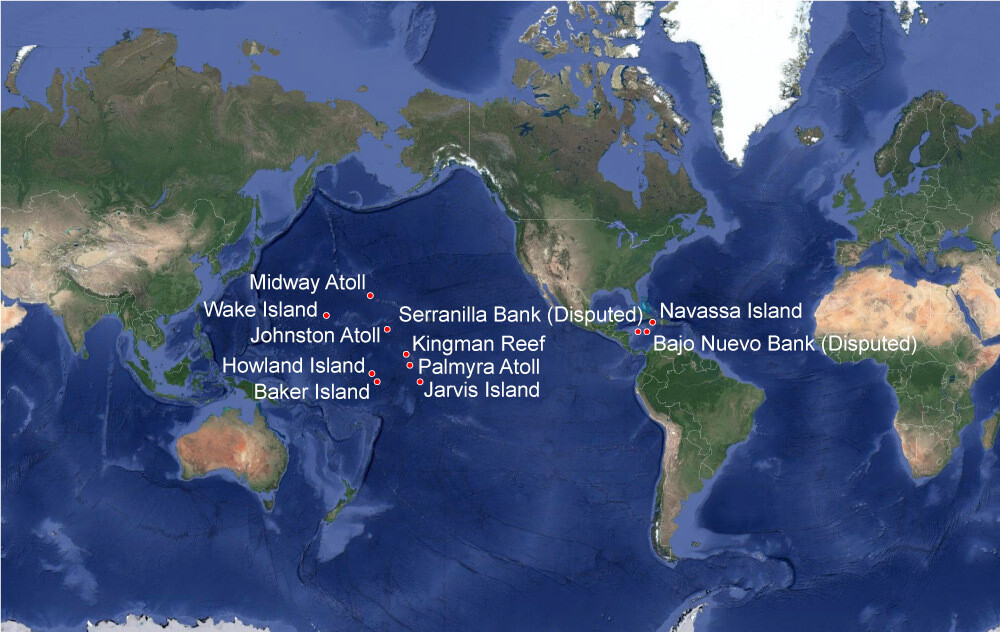
United States Minor Outlying Islands
https://clui.org/projects/unoccupied-territories-outlying-islands-americas-realm/unoccupied-territories-outlying-islands-americas-realm-0
These are nine small uninhabited islands (eight in the Pacific Ocean, one in the Caribbean Sea), most of which are closed to tourists. However, each of them has a story to tell, and in this article we are going to reveal some of the facts U.S. minor islands are known for.
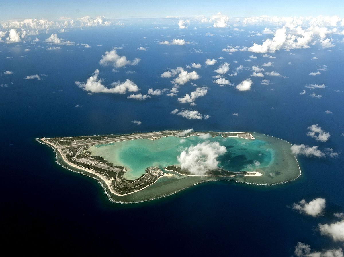
Johnston Atoll
https://www.epa.gov/pi/corrective-action-johnston-atoll
Jurisdicted by the United States Air Force, the island is closed to public entry. Access is only possible when obtaining a letter of authorisation from the USAF and a special use permit from the United States Fish and Wildlife Service. The waters surrounding the atoll are designated National Wildlife Refuge and adhere to the Pacific Remote Islands Marine National Monument. This isolated island has a significant history, although it never had an indigenous population. To find more information about the Johnston Atoll National Wildlife Refuge, visit its official site available at https://www.fws.gov/refuge/johnston-atoll.
Geography
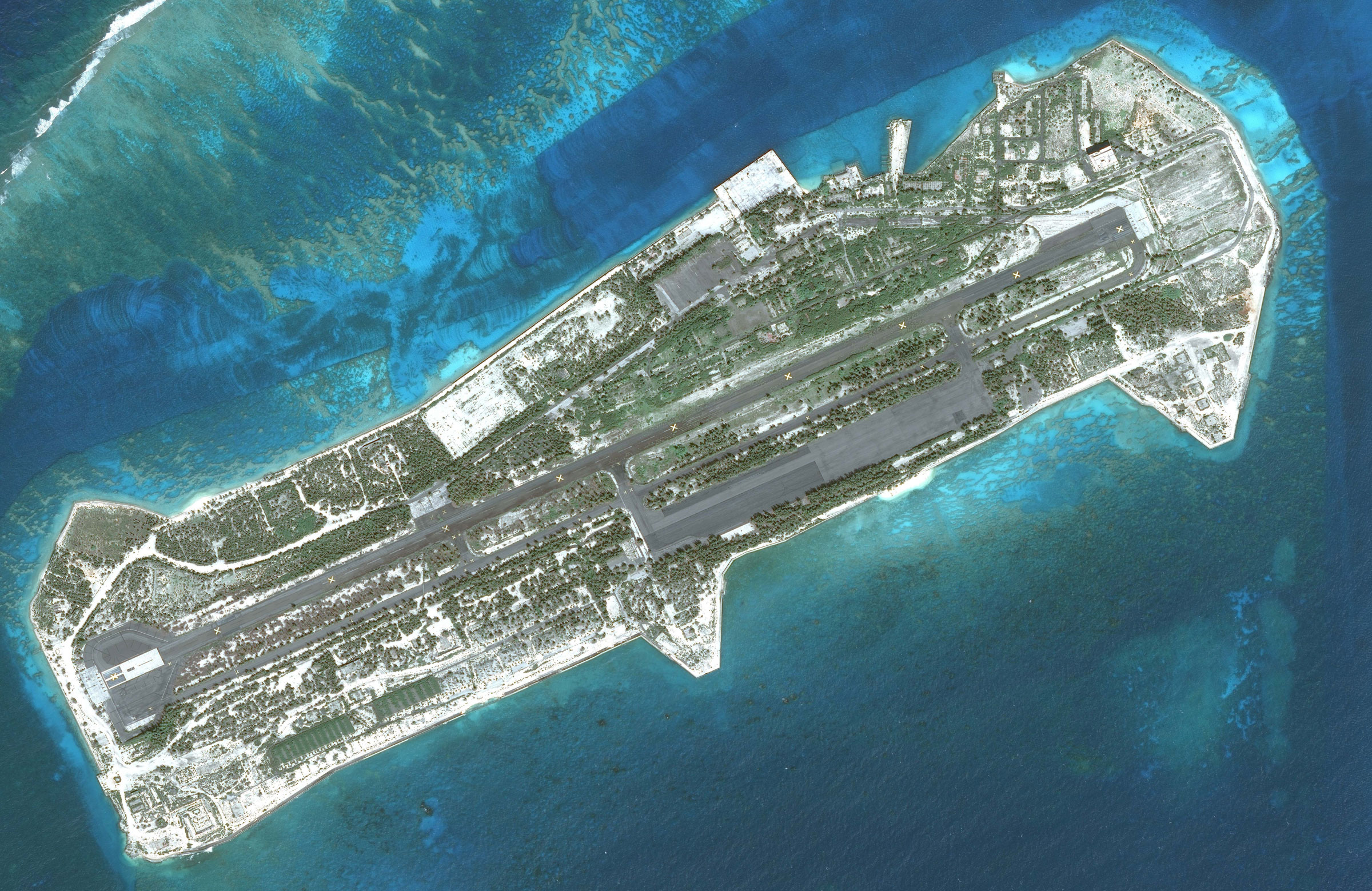
Johnston Atoll is located in the North Pacific Ocean, 1,390 km (860 mi) southwest of Hawaii. The 1,300-hectare atoll stands on a coral reef platform and consists of four islands. Johnston and Sand Islands are natural, while Akau (North) and Hikina (East) are artificial, created by means of coral dredging. Through this operation, the size of the atoll has been increased from 23 acres (1942) to 267 acres (1964). The climate is tropical dry, with Northeast trade winds and almost no seasonal temperature variation. Johnston Atoll is relatively flat, the highest point (Summit Peak) being as high as 5 m (16 ft). The vegetation is rather scarce, as there are no natural freshwater sources.
Fauna and flora
The atoll has abundant marine life, with about 300 fish species in the reefs and coastal waters. Temporary visitors include turtles, seals, and whales. There are also plenty of seabird colonies, due to which the island and its surrounding waters have been recognised as an Important Bird Area.
Plants are less diverse, including only three indigenous species. However, many new plants have been introduced to Johnston atoll during its use by humans.
History
The first record dates back to 1796, when an American ship, Sally, accidentally grounded on a nearby shoal. The captain published his discovery, but neither claimed the islands nor named them. In 1807, a Royal Navy ship, Cornwallis, sighted the islands and named them after the captain, Charles Johnston. 1856 became a starting point for guano mining, with the United States enacting the Guano Island Act. In 1858, guano deposits were discovered, and Johnston Atoll was claimed as U.S. territory. However, the same year, a representative of the King of Hawaii, Kamehameha IV, removed the American flag and claimed the atoll. He named the island Kalama in honour of the ship that brought him. In subsequent years, the ownership of the atoll was shifted between the U.S. and the Kingdom of Hawaii several times. By 1890, all guano deposits had been depleted, and in 1892, a survey was conducted in an attempt to find a new usage for the atoll. In 1898, during the Spanish-American War, Hawaii was annexed by the United States, which finally settled the ownership over Johnston Atoll.
In 1926, the island was designated as a National Wildlife Refuge after some thorough biological surveys, in the course of which hundreds of bird and fish species, along with some insect and reptile species, had been discovered. In 1926, Johnston Atoll was placed under the control of the U.S. Department of Agriculture; the Johnston Island Reservation was established. At the same time, the United States Navy began showing interest in the atoll due to strategic reasons — Johnston lies approximately halfway to Asia. This led to the 1934 placement of the islands under their control and jurisdiction.
In 1936, the erection of seaplane buildings and facilities began. In 1941, Franklin Roosevelt issued an order to create naval defence areas in the Pacific. So, Johnston Island Naval Defensive Sea Area and Johnston Island Naval Airspace Reservation were established. After that, an airfield construction was initiated. By 1943, the facilities on the island included barracks for 400 people, a mess hall, a hospital, a radio station, water tanks, and a control tower.
During World War II, Johnston Atoll became a busy air transport terminal; besides, it was used as a refuelling base for submarines and an aircraft refuelling stop for American warplanes crossing the Pacific Ocean. The island was several times bombarded by Japanese forces. On December 7, 1941, when Pearl Harbor was attacked, one of its ships, Indianapolis, was unloading at the atoll and thus escaped destruction.
After the war, Johnston Atoll Airport was used for commercial flights for both military and civilian personnel. However, in 1970, the Public Health Service issued instructions to suspend all unnecessary missile launches and flights.
Since 1958, Johnston Atoll has been used to conduct nuclear test series. High-altitude testing operations continued from 1963 to 1970. Examples of successful nuclear explosions include Starfish Prime, Checkmate, Bluegill Triple Prime, Kingfish, and Tightrope.
In the 60s, Johnston Island was used as the Recovery Operations Centre, which was responsible for collecting the radioactive scientific data obtained from nuclear detonations. At the same time, from 1965 to 1968, the island was implemented as a biological warfare test site, including testing of hydrogen bombs.
From 1971 to 2001, Johnston Atoll was maintained as a chemical weapon storage, holding 6,6 per cent of the U.S. arsenal. At different times, chemical weapons from Japan and West Germany were stored there. Agent Orange, a chemical herbicide, was also stored on Johnston Atoll after its transportation from South Vietnam and Mississippi from 1972 to 1977. Its amount was reported to reach 1,800,000 gallons. This led to a disaster — leakages from barrels and spills during operations over Agent Orange contaminated the storage area and the lagoon.
In the 1990s, the Johnston Atoll Chemical Agent Disposal System was built, marking the beginning of the demilitarisation mission. By 2000, all chemical weapons were demilitarised, and all hazardous waste materials were destroyed. In 2003, Johnston Atoll was deemed environmentally remediated.
The 21st century saw the unmaintained runway, which could no longer be used as a landing place. Almost all the structures and facilities were removed; the only remaining were the Joint Operations Centre, some chemical bunkers, and a Quonset hut.
The military mission on Johnston Atoll ended in 2004 when the base was closed, and the Pacific Remote Islands National Wildlife Refuge Complex administered the area. The Fish and Wildlife Service took control of islets and waters, and some land remained under the control of the United States Air Force and the Defense Threat Reduction Agency. In 2009, George Bush established the Pacific Remote Islands Marine National Monument, which included six other islands. The total area contains 696 acres of land and 800,000 acres of water.
The latest population of Johnston Atoll included a group of 10 people called the Crazy Ant Strike Team. The project led by the U.S. Fish and Wildlife Service had the task of eradicating crazy ants' colonies, which swarmed the island in 2010. The poisonous insects threatened seabird colonies nesting on the atoll. In 2021, full eradication was completed. You can read about the team's life and struggle on their website: https://castawaysinparadise.wordpress.com/. It also contains plenty of photographs showing the current landscape of Johnston Atoll, which are interesting because of the place's post-apocalyptic lure — run-down buildings combined with flocks of seabirds.
Jarvis Island (a.k.a. Bunker Island)
https://www.pinterest.com.au/pin/jarvis-island-seen-from-space-in-2005--357262182924036039/
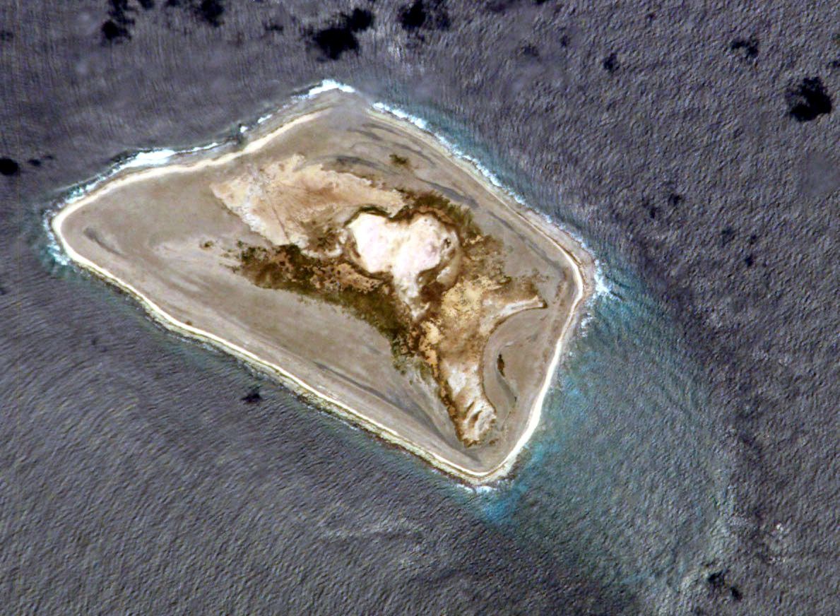
This uninhabited coral atoll with a dry lagoon is located halfway between Hawaii and the Cook Islands. Its area is 4,5 km2, and it is administered by the United States Fish and Wildlife Service of the U.S. Department of the Interior. Jarvis Island is classified as one of the Line Islands—a chain of 11 atolls, 8 of which adhere to Kiribati.
In the 19th century, it was implemented for guano mining. In 1935, the town of Millersville was established, and a day beacon was erected (it is still standing there). The settlement existed until World War II broke out. Since 1974, Jarvis Island has only been used as a National Wildlife Refuge.
Baker and Howland Island
https://blog.howlanders.com/en/news/the-story-behind-howlanders/
Like almost all the other minor islands, these two were used by the United States as guano mining sites in the 19th century. Some colonists lived on the islands from 1936 until the Japanese air and naval attacks of 1942. Since then, the land has remained unoccupied.
Howland Island is famous as the place where aviatrix Amelia Earhart and Fred Noonanduring aimed to land during their round-the-world flight before their mysterious dissappearance.
Both islands are National Wildlife Refugees administered by the U.S. Fish and Wildlife Service. Their climate is almost the same as that of Jarvis Island, and they are also home to many bird, reptile, and fish species.
Wake Island
https://facts.net/nature/universe/16-astonishing-facts-about-wake-island/
The island, located about halfway between Hawaii and Japan, is best known as a World War II battle site. Together with Pearl Harbor, it was successfully attacked by Japanese forces in December 1941.
Today, Wake is implemented as a military base operated by the U.S. Air Force and is included in the Pacific Remote Islands Marine National Monument territory.
This coral atoll of 5 square miles with no water supply, in 1941, however, had an airport and almost 500 servicemen, as well as 1,200 civilian contractors, working on it. Unfortunately, during the attack, all but 98 civilians were killed, and the survivors were executed in 1943. In 2009, the United States' ownership and military control of Wake Island was restored. In 2014, a protected area of the monument was increased to 490,000 square miles.
The island is tightly guarded because of the presence of secret military facilities, so a touristic visit is impossible.
Midway Atoll (Kuaihelani)
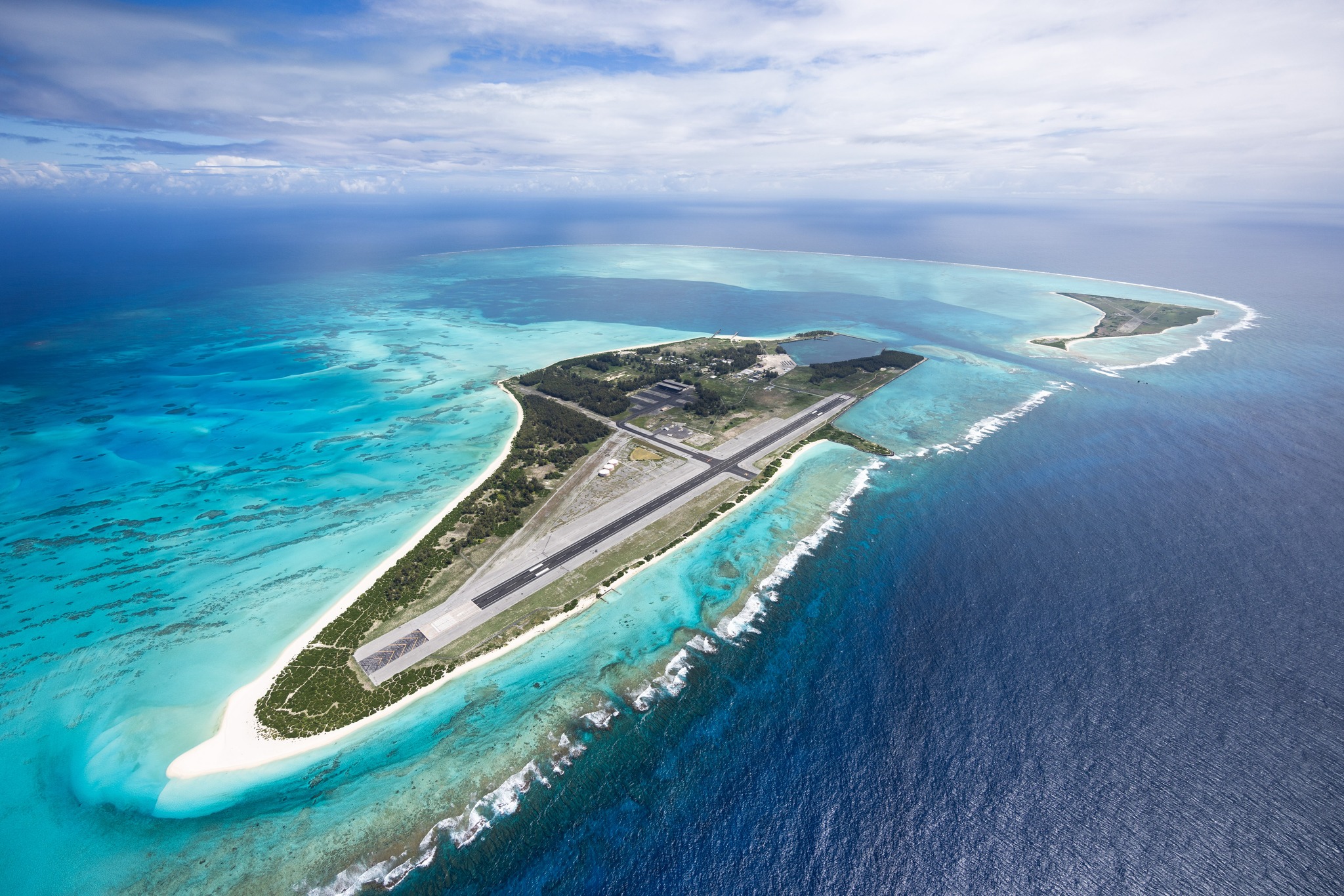
The atoll consists of an elliptical outer reef, a submerged reef and three flat coral islands — together, 1,549 acres. The largest islands are Sand Island and Eastern Island.
Midway Atoll National Wildlife Refuge was established in 1988 under the Navy's jurisdiction to protect the area's natural and historic resources. This area is also part of one of the largest conservation areas worldwide, Papahānaumokuākea Marine National Monument, with an area of 582,578 sq mi or 1,508,870 sq km. Midway Atoll is an important nesting place for approximately 3 million birds yearly, including some rare and endangered species. Reefs surrounding the atoll are home to 163 species of fish and 16 species of corals.
In 2000, the Battle of Midway National Memorial was created. When Pearl Harbor was bombarded, some military men on Midway survived. Six months later, on June 4, 1942, the battle began, becoming a turning point in World War II. Two-thirds of the Imperial Japanese Navy was destroyed, so from then on, the attackers were forced to turn to a defence strategy. The U.S. forces also sustained considerable losses, spurring the production of new ships and aeroplanes.
Kingman Reef
https://www.fws.gov/refuge/kingman-reef
The smallest land formation of all the U.S. minor islands, this atoll is just 90 nmi (20 km) from east to west and 4,5 nmi (8 km) from north to south. It is situated nearly halfway between the Hawaiian Islands and American Samoa, 67 km northwest of Palmyra Atoll. The United States Fish and Wildlife Reserve administers the reef under the title Kingman Reef National Wildlife Refuge.
The atoll was discovered in 1798 and first described in 1853 by Captain W.E. Kingman (thus, the name). In 1859, the United States claimed Kingman Reef, and in 1922, the American flag was raised on the atoll, making the reef officially annexed. During the 1930s, the reef was sometimes used as a stopover (halfway station) for flying boats travelling between North America and New Zealand.
As Kingman Reef is just a tiny flat piece of land that is awash almost all the time, it has no resources and is important only due to abundant marine life. Its reef consists of approximately 130 species of corals, which is over three times more than in the Hawaiian Islands). The atoll is closed to the public.
Palmyra Atoll
https://www.parcresearch.org/palmyra-atoll
This is the only one of U.S. minor islands which is open to tourists. If you don't work or volunteer for Nature Conservancy and don't conduct scientific research, you have to either receive an invitation from the Nature Conservancy or visit the atoll on your private sailboat or motorboat.
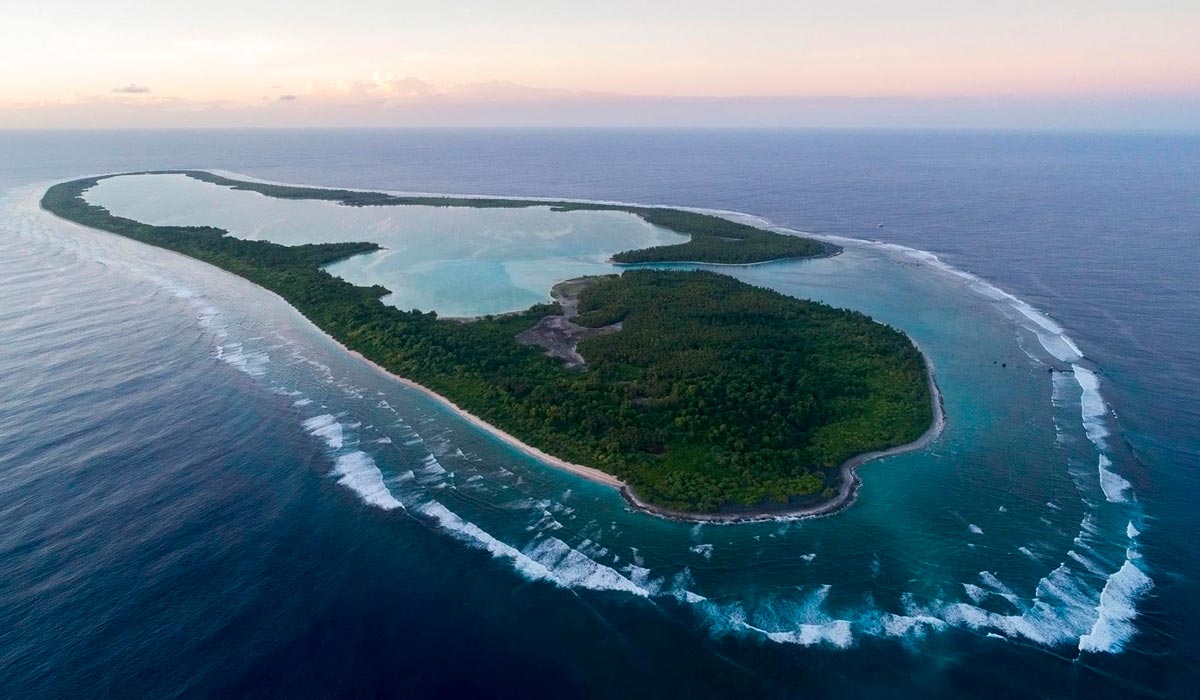
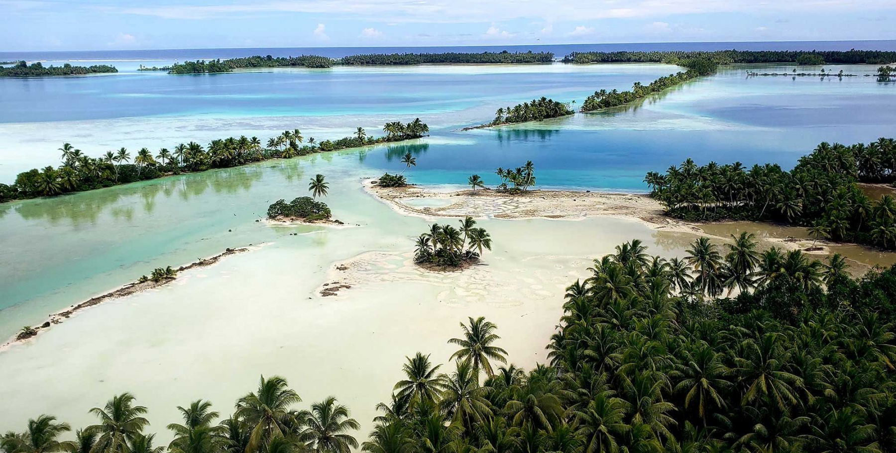
Palmyra is one of the Northern Line Islands and is located one-third of the way between Hawaii and American Samoa. Its area is 12 km2 (4,6 square miles), and it has no permanent population. The only boat anchorage, West Lagoon, is accessible by an artificial channel.
The coral atoll has many islets: Sand Island, two Home islets (west), Quail, Whippoorwill, Bunker, Cooper-Meng (joined in 1940), Strawn (north), Eastern, Papala, Pelican, Fern, Bird, Barren (east), Bird Island, Holei Island, Engineer Island, Tanager Island, Marine Island, Kaula Island, Paradise Island (south).
Palmyra Island has been known since 1802 and has been owned by the United States since 1898. Like the other U.S. minor islands, it was used as a military base during WWII and even had an airport, which is now abandoned. Now, the island is managed by the U.S. Fish and Wildlife Service and the National Oceanic and Atmospheric Administration.
Navassa Island
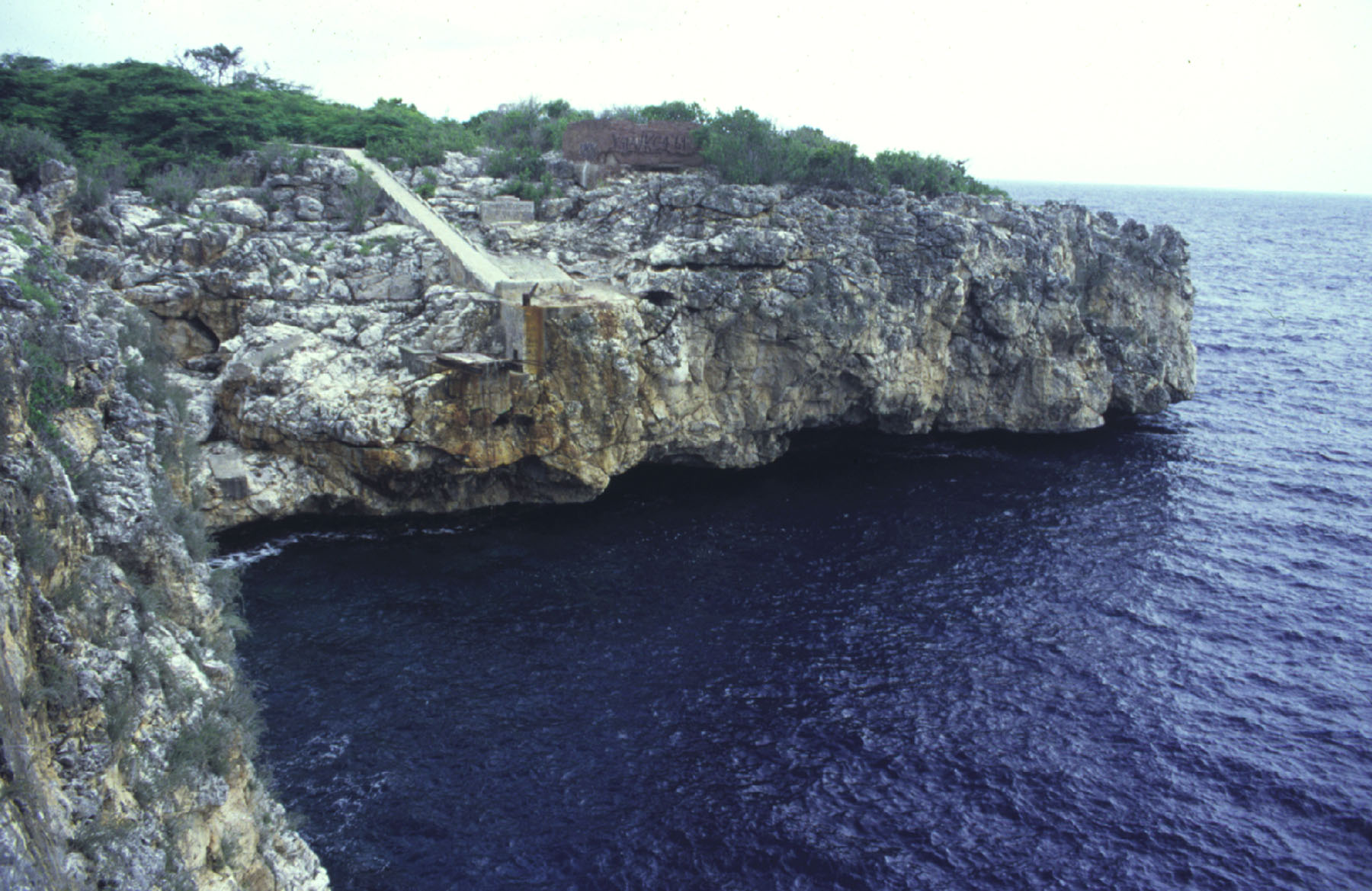
https://7toucans.com/en/things-to-do-when-traveling/caribbean/navassa-island-u-s/1979-navassa-island/gallery
This is the only island adhering to U.S. minor islands that is situated in the Caribbean Sea. It is northeast of Jamaica, south of Cuba, and 74 km (46 mi) west of Haiti. The political status of Navassa is still being disputed between the United States and Haiti.
Navassa was discovered in 1504 by Christopher Columbus. It was claimed by the United States in 1857, based on the same Guano Islands Act that led to the claiming of all the other minor outlying islands. Guano phosphate mining continued from 1865 to 1898. During that time, a town called Lulu was built, along with a lighthouse, a keeper's quarters and a wireless telegraphy station. Since 1999, Navassa Island has been made a National Wildlife Refuge due to its rare coral species and large seabird colonies. It is administered by the U.S. Fish and Wildlife Service.
The refuge is closed to the general public because of hazardous coastal conditions and preservation of the habitat. However, a visit is possible under permission of the Fish and Wildlife Service.